STORY #3: Where Was the Golf Course?
When the Omaha Country Club first opened, its grounds stretched roughly from 52nd to 56th Streets and from Blondo Street north to Military Avenue — an area that would later shape the curving streets and triangular lots of today’s Country Club neighborhood.
The Club’s original course included nine holes for “the men and experts.” A 1900 article in The Omaha Bee described it as having: “not a tree or shrub upon it… a tough, firm sod of fine old bluegrass.”
The course zig-zagged through a deep gulch — Cole Creek — whose slopes added both beauty and challenge, giving the course a “hazardous tone” and a dramatic, picturesque landscape. To make the sport more accessible, the Club also built a second six-hole course on level ground for women, children, and beginners, with fewer bunkers and hazards.
By 1905, the Club expanded its property by another 40 acres and replaced the two separate courses with a single 18-hole layout. This new course still stretched from 56th to 52nd Streets, between Military Avenue and Blondo Street, with three additional holes extending southeast of 52nd Street.
Historic maps — including Sanborn Fire Insurance maps and Omaha city plats — show the course extending:
East toward 50th Street
South toward Seward Street, and
Back west toward 51st and 52nd Streets
The rolling fairways, greens, and creek valleys from this early golf course left a lasting imprint on the land — creating the winding streets and distinctive lot shapes still visible throughout the neighborhood today.
Can you find the (future) location of your house on the golf course map? Which hole would your house have been on?
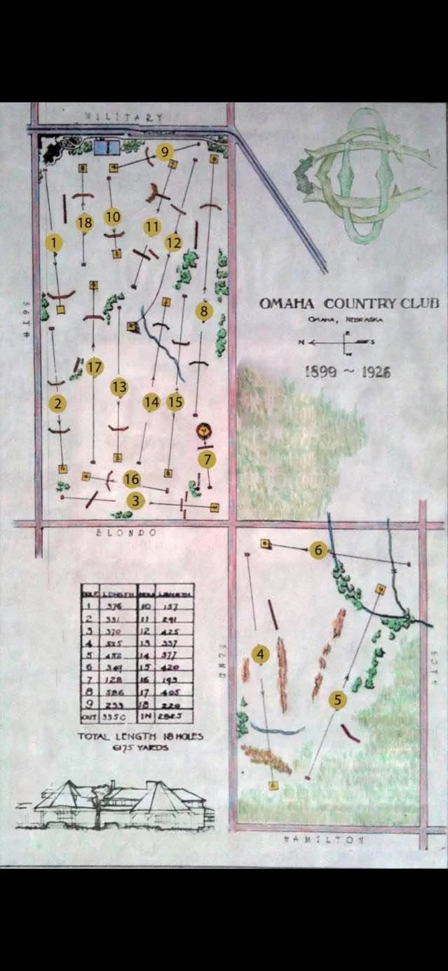
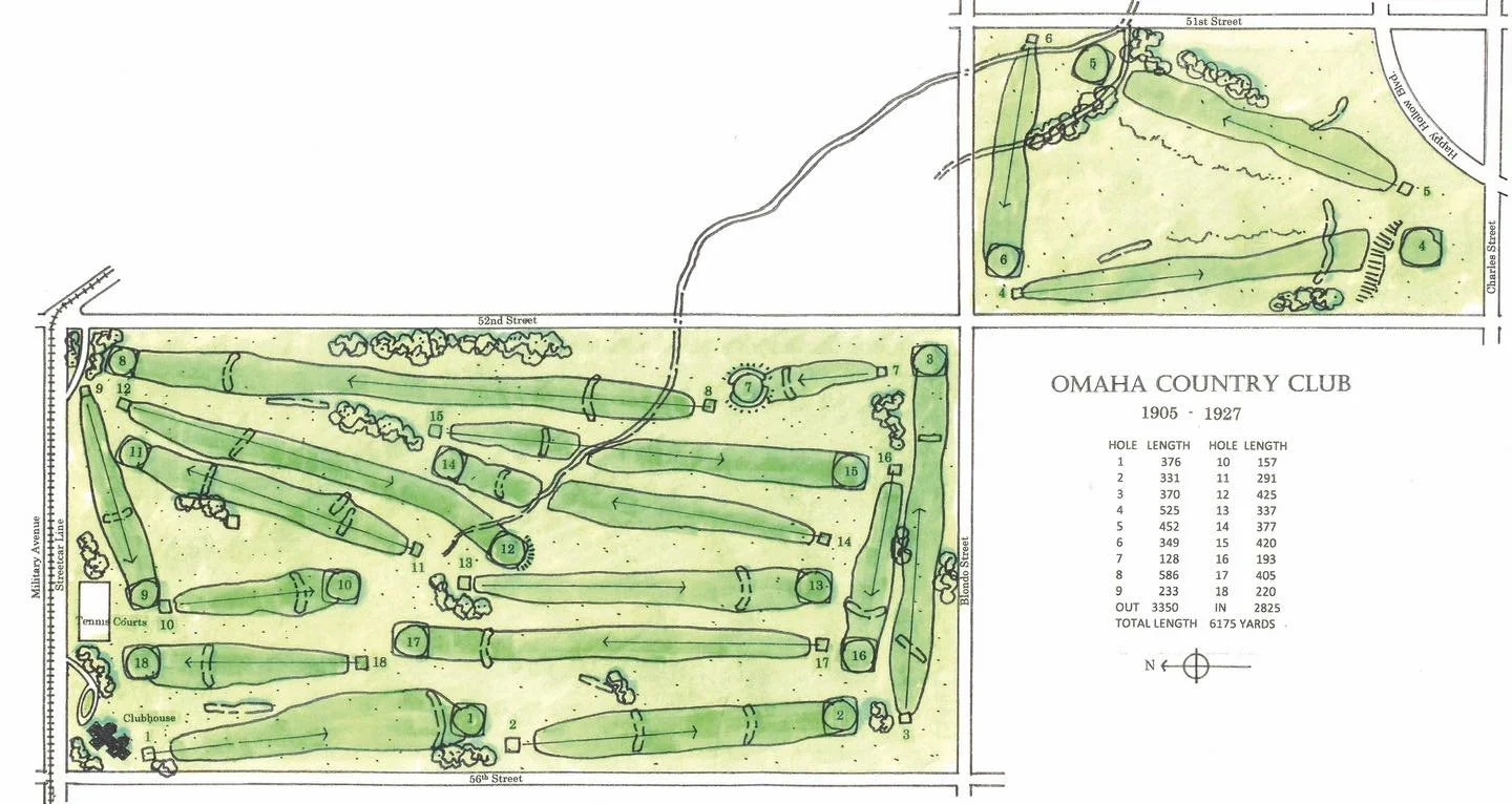
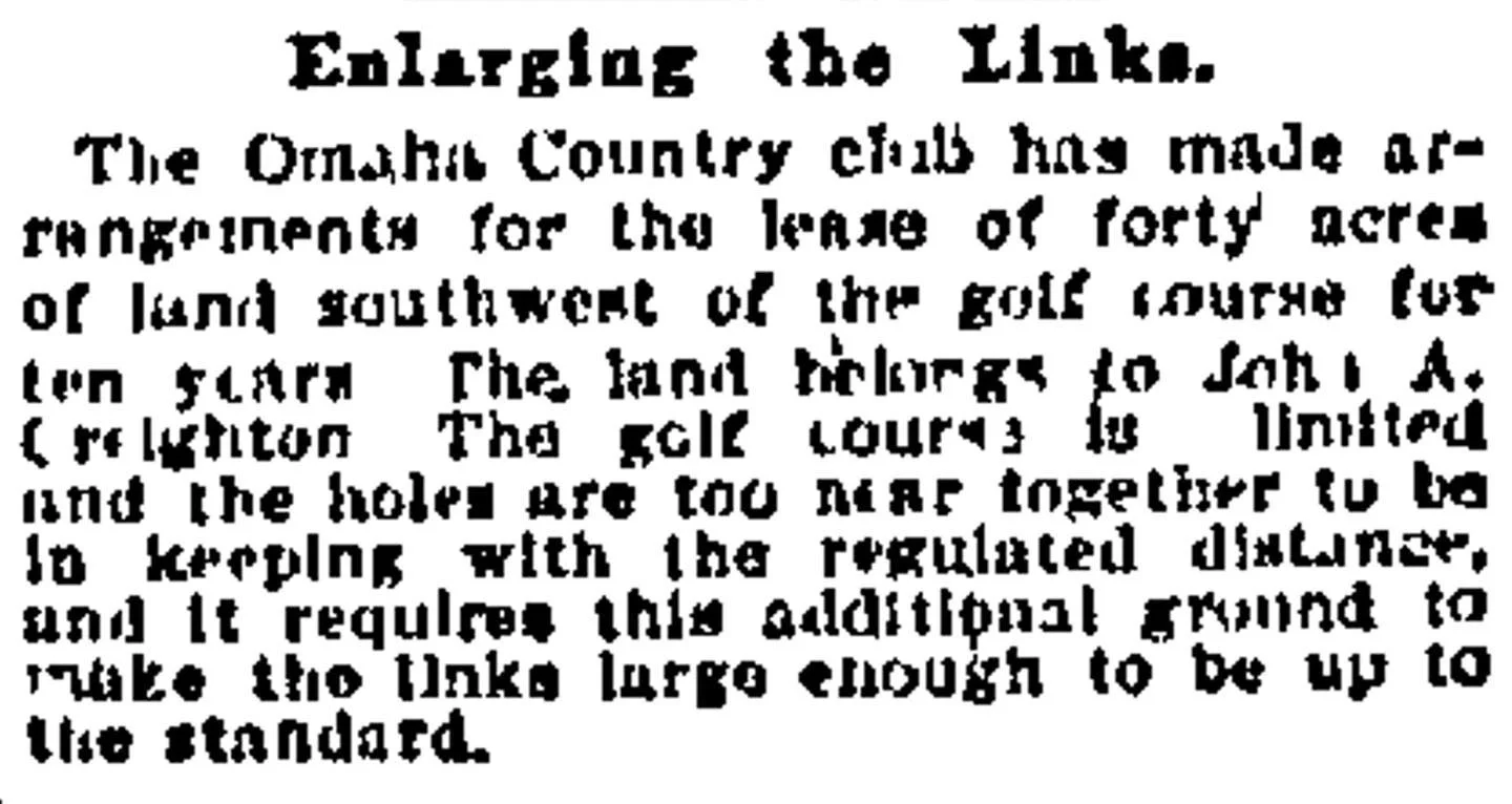
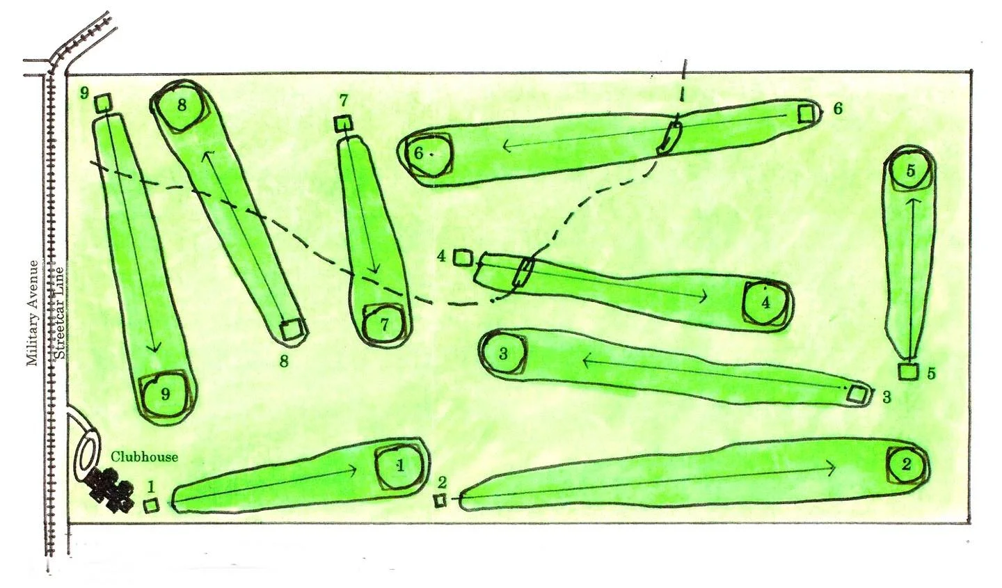
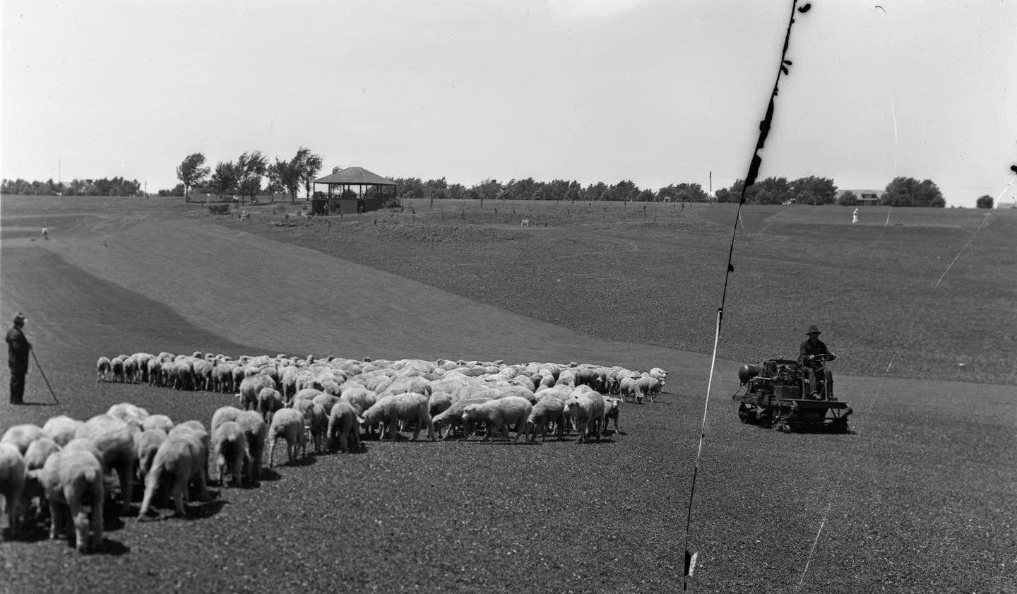
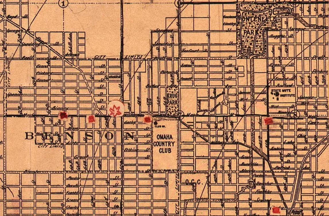
Photo Credits:
1) Omaha Country Club Map
2) OCC Golf Course courtesy Omaha Country Club
3) Enlarging the Links courtesy Omaha World Herald, April 30, 1905
4) OCC Golf map courtesy Omaha Country Club
5) Sheep on golf course courtesy The Durham Museum, BF8-4897
6) Omaha Map showing OCC expansion courtesy Omaha Public Library